- Savegre RiverCold, clear water between boulders under the forest. Walk the bank in the morning. It is not a swim. The birds are in the trees above it.
- Quetzal morningThe useful hour is first light, with a local guide who knows the trees. A quetzal is not guaranteed. By late morning the forest is quieter and the cloud is lower.
- Los Quetzales National ParkThe gate is the marked trail, not a wander up the ridge. Mud is normal even in a drier month. Ask the hours that morning, and come down before the rain sits on the road.
- Trout lunchFarms along the river raise trout in the cold water. Lunch is the visit. It is not a hike, and it is not the birding hour.
- Valley lookoutPull off only where the shoulder is wide. The valley and the Talamanca ridge show when the cloud lifts. There is no ticket booth and no platform.
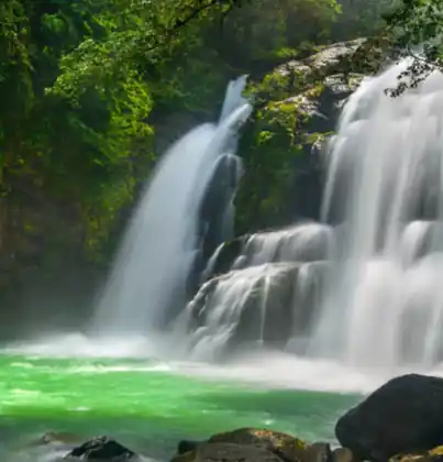
- Side waterfallA short trail drops to a fall on a side stream. The rock is slick. Go down in the morning and climb out before the afternoon rain.
- Garden birdsHummingbirds work the flowers by the lodges at first light. Stand still. Do not play a bird call into the forest.
- The nightAfter dark the valley is cold and quiet. There is no town strip and no late restaurant. Eat where you are sleeping.
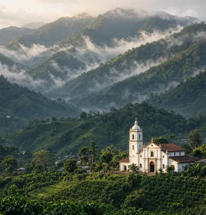
The landscape is high cloud forest, a cold river, and a narrow valley. You are likely to see resplendent quetzals, hummingbirds, chlorophonias and sooty thrushes. The plants around them are oak, moss, bromeliads and the trees along the Savegre.
Around San Gerardo de Dota, quetzals are a morning with a guide, and not every morning. Hummingbirds are in the gardens at first light. By noon the cloud is often in the valley.
Los Quetzales National Park and the private forest along the Savegre, which is why the birds are still here.
In San Gerardo de Dota, stay on the trail and do not feed what you came to see. That is the rule that keeps this place the way it is.
The climate is high cloud forest. It is cold, about 8–18°C. Mist and rain are normal. Mornings are the clearer hour. San Gerardo de Dota sits at 2,200 m (7,220 ft).
Pack a real jacket, including for the afternoon. The countrywide calendar is in the best time to visit Costa Rica.
The airport is Juan Santamaría in Alajuela. The drive south from San José takes longer than the map suggests, and the last stretch into the valley is steep.
Arrive in daylight if you do not know the road. Buses, shuttles, and rental cars are compared in getting around Costa Rica.