Cartago is the old capital, east of San José, and it was the capital until 1823. Irazú and Turrialba sit above the valley. There is no beach in this province, and the main airport is in Alajuela. Most trips use it as a morning, not as a base. Cartago, Orosi, and Turrialba are Central Valley pages, not a coast.
Where Cartago is
The capital of the province is Cartago, and it was the capital of the country until 1823. It sits east of San José, still in the Central Valley, then up to the volcanoes and south into the Orosi Valley. The city is smaller than San José. Cartago is the valley and the craters.
On this site Cartago, Orosi, and Turrialba are filed in the Central Valley. There is no beach in this province. The highway toward the south Pacific passes this way before it drops to the coast. That does not make Jacó or Quepos part of Cartago. The line stops in the mountains.
From about May to November the valley floor gets the same afternoon showers as the rest of the Central Valley. December to April is the clearer season, and even then the crater can close in by late morning. The summit makes its own cloud. Most trips use Cartago as a morning, not as a base.
Getting around
The main airport is Juan Santamaría (SJO), in Alajuela, not here. Cartago is about an hour from the center of San José when the road is moving, and less if you are already on the east side of the capital. It is a day trip. It is a bad add-on to a flight day.
Route 2 is the highway in from San José and on to the south. Irazú is another hour above the city, and that hour has to be early. The crater road is the one that fogs in. Come down before dark. Turrialba is the farther cone, east of the city, and it is not the same morning. The road is paved to the rim, which is why people treat it as easy. The cold is the part they forget.
Do not use a beach forecast. The province is cooler than San José, and cold at the crater. A jacket is the difference between a fine morning and a miserable one.
Parks and protected areas
These national parks are in Cartago: Irazú Volcano, Turrialba Volcano, and Tapantí. Guayabo National Monument is here too. It is a monument, not a national park.
Cartago province is east of the capital, still in the Central Valley, then up to the volcanoes and south into the Orosi Valley. On this site that is Cartago, Orosi, and Turrialba. The city is smaller than San José. Cartago is the valley and the craters.
The highway toward the south Pacific passes this way before it drops to the coast. That does not make Jacó or Quepos part of Cartago. The province line stops in the mountains.
Cartago province is about an hour from the center of San José when the road is moving, and less if you are already on the east side of the capital. It is a day trip. It is a bad add-on to a flight day. Irazú is another hour above the city, and that hour has to be early.
The drive is the Central Valley, not a mountain expedition, until you turn up to the crater. The crater road is the one that fogs in. Leave time to come down before dark.
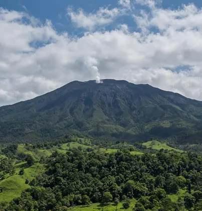
Yes. Cartago is the usual way up. Two pits sit at the top, and one holds a green lake when the cloud lifts. Be there at opening. Late morning is often white, and a white crater is still the visit, not a reason to wait for afternoon. Turrialba is the farther cone, east of the city, and it is not the same morning.
Check that the park is open before you leave. The road is paved to the rim, which is why people treat it as easy. The cold is the part they forget.
Cartago province is cooler than San José, and cold at the crater. A jacket is the difference between a fine morning and a miserable one. From about May to November the valley floor gets the same afternoon showers as the rest of the Central Valley. The summit makes its own cloud on top of that.
December to April is the clearer season, and even then the crater can close in by late morning. Do not use a beach forecast. The weather guide is for the coasts. This page is for the cold hour above the valley.
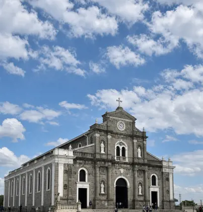
For most trips, no. See the basilica, go up Irazú, and sleep in San José, Alajuela, or Heredia, where there is more choice after dark. Stay if the next morning is Turrialba, Guayabo, or the Orosi loop and you do not want to cross the city twice.
There is no reason to base a beach week here. The coast is still a long drop down the mountain, and you would do that drive every day.
The local attractions in Cartago province are Irazú Volcano, the Basílica de los Ángeles, Lankester Garden, Guayabo, and the Orosi Valley. None of them is a beach, and none of them is the airport.
- Irazú Volcano: The highest crater you can drive to. Two pits sit at the top, one with a green lake when the cloud lifts. Go at opening. Late morning is often white.
- Basílica de los Ángeles: The city church holds the small statue people walk to on August 2. Step in between services. It is not a ticketed museum.
- Lankester Garden: An orchid garden outside Paraíso, a short drive from the city. Morning is the walk. A couple of hours is enough.
- Guayabo: A pre-Columbian town near Turrialba, with stone mounds and a raised road. It is a morning, not a city stop. Ask the hours that day.
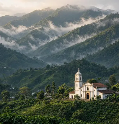
- Orosi Valley: A loop of coffee, a colonial church, and a look down the valley. The road is the visit. Stop only where the shoulder is wide.